
The Mojave Road
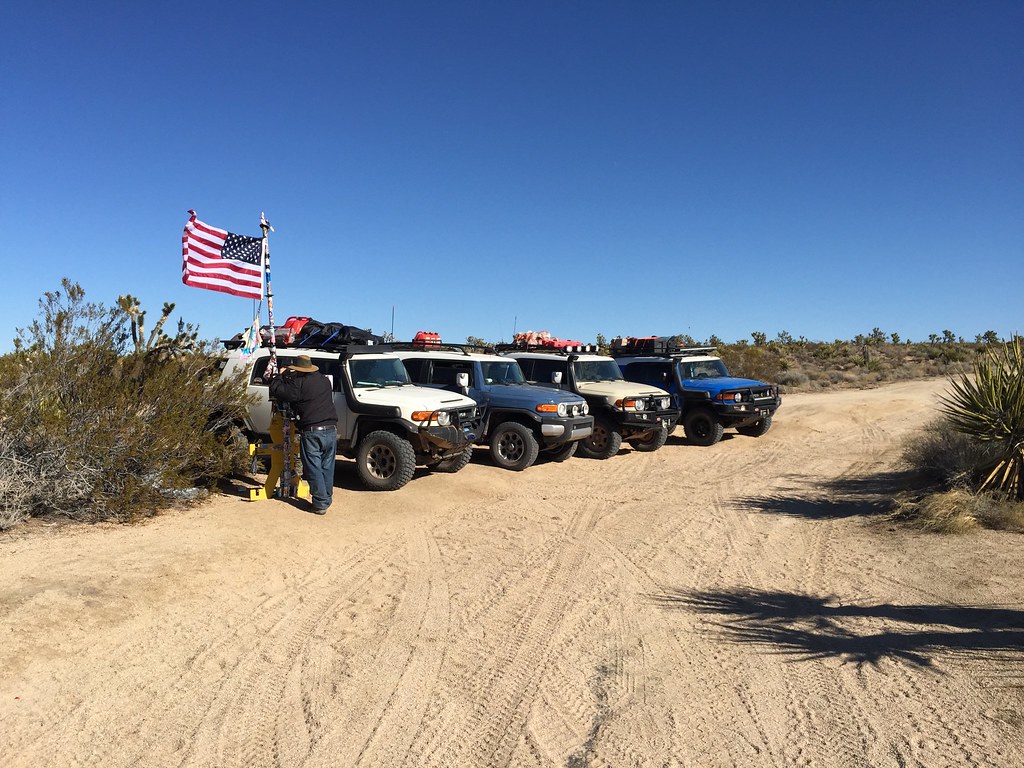
We just completed a post Christmas trip to the Mohave Road. The trip was organized by a fellow FJ Owner and adventure enthusiast Eric Rogers.
Trip Report:
We had great weather for the entire trip but the temperatures dropped to below freezing every night. We also had an unplanned mechanical issue on day 2. A front shock broke on one of the FJ’s. So plans got modified. We helped him get back to Hwy 95 and a gas station and then he was towed to Las Vegas for repairs. The good news 24 hours later he was able to rejoin the group on day 3. Because of this we camped twice at the Mid Hills Campground and just explored the area as a day trip while leaving our camp set up in place. On day 3 we retraced our route back to Rock Spring, visited the Death Valley Mine ner Cima, and the Kelso Train Depot. There are no services or fuel in this area unless you drive up to Baker.
Day 1: Phoenix to Balancing Rock Campground
Day 2: Balancing Rock to Mid-Hills Campground (A good portion was in the dark due to mechanical issues)
Day 3: 130 miles of driving near Mid-Hills Campground (Death Valley Mine, Rock Spring and Smith Homestead and the Kelso Depot)
Day 4: Mid-Hills to Soda Lake to finish the trail. We stopped in Baker along the way, then headed west to loop back eastward across Soda Lake. Then the long drive home!
Ham radio and APRS tracking proved very useful. We were able to find some people on Soda Lake and ask them about the current conditions prior to our entry. We were also able to communicate with Rim Link back in AZ on the Smith Peak Repeater along with one in Kingman (Hualapai Peak).
Useful Gadget of the Trip: Two people in our party had Mr Heater Portable Buddy Propane Heater. I am totally sold on this device and purchased one. With the temperatures well below 32 it was nice to heat the tent while reading and changing.
Best Book: Mohave Road Guide $19.95
Best Map: Mohave National Preserve
Introduction
The Mojave Road is an east-west route that enters the park near Piute Spring on the east side and on Soda Dry Lake near Zzyzx on the west. The Mojave Road or Mojave Trail is a historic route and present day dirt road across what is now the Mojave National Preserve in the Mojave Desert in the United States. This rough road stretches 140 miles (230 km) from the site of the old Fort Mohave (on the west bank of the Colorado River, roughly 10 miles southwest of Bullhead City, Arizona) to the site of the old Camp Cady (on the west bank of the Mojave River, roughly 12 miles northeast of Newberry Springs, California). A four-wheel drive vehicle is required for all but a few short stretches of this road, which is unmaintained. Under optimal conditions, its full length can be travelled in 2 to 3 days. (https://en.wikipedia.org/wiki/Mojave_Road)
Used by Indians to transport goods from the southwest to trade with the Chumash and other coatal tribes, this route later served the cause of westward expansion. Military forts were established along the route to protect key water sources and provide assistance for travelers. Today it is a popular four-wheel drive road. (https://www.mojave-road.com/)
A traditional thoroughfare of desert-dwelling Native Americans, the road much later served Spanish missionaries, explorers, and foreign colonizers and settlers from the 18th to 19th centuries, and ran between watering holes across the Mojave Desert between the Colorado River and San Bernardino Mountains in Southern California. The watering holes recur at intervals of about 60 to 70 miles.
Francisco Garcés, the Spanish Franciscan missionary, traveled the trail with the expedition of Juan Bautista de Anza in 1776. José María de Zalvidea, the zealous Franciscan administrator of Mission San Gabriel also crossed the trail in 1806, reportedly converting five indigenous Mojaves near present-day Hesperia. In 1826, Jedediah Smith became the first American to travel the Mojave Road.
The land passed to American hands in 1848, and the trail came under the purview of the U.S. government. Army posts were established at Fort Mojave in 1859 and at Camp Cady in 1860, with smaller outposts along the trail and regular patrols. The army protected the settlers and travelers from the territorial attacks of the resident Paiute, Mojave and Chemehuevi Native Americans. This also opened the way for agricultural development in the Victor Valley area.
The eastern end of the Mojave Road begins at the edge of the Colorado River north of Needles and the western terminus lies beyond the Rasor Off-Highway Vehicle Area and the Afton Canyon Natural Area near the Manix Wash. (https://en.wikipedia.org/wiki/Mojave_Road)
Mojave National Preserve is a camper’s paradise. Developed campgrounds, roadside camping, and backpacking offer opportunities for individuals and groups of diverse ages, interests, and skills. Careful planning and knowledge of camping guidelines and regulations will help ensure an enjoyable and safe experience for you, future visitors, and the fragile desert environment… The following link opens a PDF that explains the rule and prices for the established campgrounds – https://www.nps.gov/moja/planyourvisit/upload/camping_sb_bl_LowRes.pdf
To continue the preservation of this area, please remember the seven principles of Leave No Trace in your planning for this trip. – https://lnt.org/learn/7-principles
Overview Map – from https://www.mojave-road.com/maps/mojave-national-preserve-map-1.pdf
Campsite Overview Map – from https://www.mojave-road.com/maps/mojave-road-camping-map-2.pdf

Road Conditions
All vehicles operating within Mojave National Preserve must be street-legal in accordance with California DMV requirements. This includes current registration and tags, lights and turn signals, and valid insurance. California “Green Sticker” and “Red Sticker” programs are not recognized with the preserve.
Not all roads are shown on all maps; traces and illegal shortcuts add to the confusion. Travel only on existing, open roads and not cross-country. Creation of new routes and driving in washes are not permitted.
Some sections are rough and sandy; 4 x 4 recommended. Roads can become slick, muddy and impassable after rains. Be sure to inquire about road conditions, especially if you plan to cross Soda Dry Lake.
General Information:
Current road and campground status – https://www.nps.gov/moja/current-conditions.htm
Maps
A series of (19) TOPO maps with the main route identified – https://www.mojave-road.com/mojave-road-maps.htm
A map with the location of the Mojave Cross – https://www.mojave-road.com/maps/mojave-cross.pdf
NPS overview map of the Mojave Preserve (same as above) – https://www.mojave-road.com/maps/mojave-national-preserve-map-1.pdf
NPS overview map with designated campsites identified (same as above) – https://www.mojave-road.com/maps/mojave-road-camping-map-2.pdf
Resources:
https://www.nps.gov/moja/planyourvisit/mojave-road.htm
The Mojave Road Guide by Dennis Casebier provides mile-by-mile descriptions of the road. It is available from park information centers or by mail from Western National Parks Association.
GPX Tracks –
