
Grand Canyon North Rim Exploration
Notes from the run:
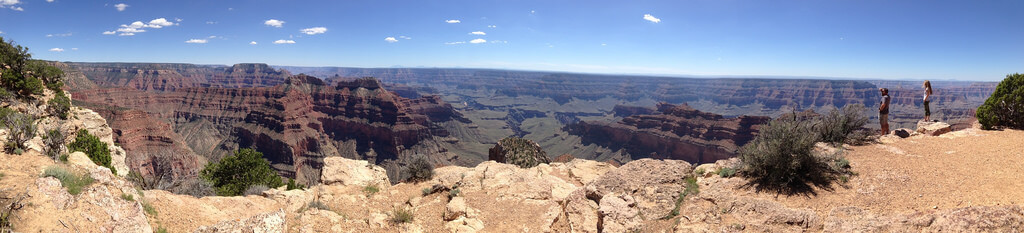
The trip went mostly according to plan. Everything changed when we paid a visit to the Back Country Office inside of the park. We got lucky and were able to reserve the Fire Point camp area for the night. In fact we could have booked it for two nights. I would have been happy to stay there but others wanted to see what else we could find. Day 2 we finally found a nice secluded spot outside of the GCNP but still with walking distance of the rim. I would highly recommend this trip. The views from the North Rim are amazing. Less people, less traffic, and plenty of great places to camp. On day 2 we made it to Sublime point. Both camping spots were open, but reserved. I have my doubts as to whether those with reservations ever showed up. One group was camped in an illegal spot. Oh well. Next trip we plan I will try to reserve Sublime for at least one night.
On our border to border run we passed the entrance to the North Rim of the Grand Canyon but didn’t have time to go exploring. With the fun of the AZ border to border run fresh in our minds a few of us thought this would be a great weekend to return. In my 25+ years in AZ I have never explored the North Rim. Nows the time! Plan on 3 days of camping unless you head up to Flagstaff early Saturday.
Season Mid-May to Mid-October: https://www.nps.gov/grca/planyourvisit/hours.htm
Day 1 (Friday) – Head up to Flagstaff and explore the cinders area. Camp near Sunset Crater – Location TBD Some may stay in town as well. Since most have to work Friday we decided this would be a good day 1 place. It is approximately 5.5 hours from Phoenix to the entrance to the north rim and that is a bit to long in 1 day to also allow for trail runs.
Day 2 (Saturday) – Flagstaff to North Rim. Leave by 8:30AM
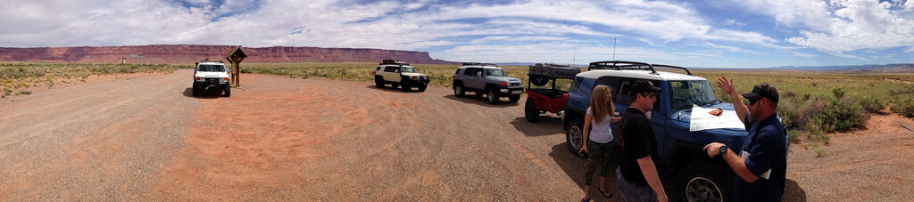
We will work our way up 89 to Marble Canyon (Fuel Stop) then on towards Vermillion Cliffs. Here we will take a “short cut” scenic road to the north rim. Buffalo Ranch Road to 220 then 67 for a bit. Then on towards Point Sublime Road for our scenic journey along the north rim.
Explore the area and include an afternoon light hike along the rim WX permitting. Pick a camping spot.
My Life Outdoors has some great info on the north rim.
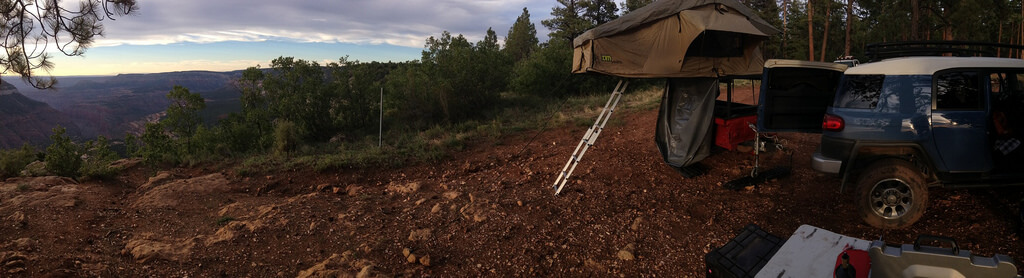
Fire Point
Day 3 (Sunday) –
Option 1 – Stay in the area and do more exploring while leaving our base camp intact.
Option 2 – Head north and visit the Coral Pink Sand Dunes near Kanab and then head towards Vermillion Cliffs for exploring and camping. Lots of off shoots from the main road on the Border to Border run that are worth exploring. We can take FR22/Ryan road out of the north rim to Fredonia. This is the scenic road out vs 67 to 89a. Camp in the Vermillion Cliffs area and head south home from there.
Day 4 (Monday) –
A short trail run TBD and then the long ride home via 89, Marble Canyon, Flagstaff…..
North Rim Backcountry information
Point Sublime Road GPX File: https://www.gaiagps.com/public/OPgqfFDf7TRqoRe7nrQvtxpj/Aerial/
Proposed Route:
From 89 NW of Marble Canyon we will turn left on Buffalo Ranch Road
Then Right on 220 (Tater Ridge Rd) a small portion of this is on the AZ Trail.
220 runs into East Rim Ridge Rd (611) we take this south until it intersects with Hwy 67 and the North Rim Entrance Station. There we will be required to pay the $25 entrance fee. https://www.nps.gov/grca/planyourvisit/entrance-fees.htm
We then head south of 67 until we reach the Backcountry office – There we will take a break and talk with the rangers on any last minute possible camping spots that require permits. Otherwise there are no fees to camp in primitive areas.
After visiting the Backcountry office we will head for Point Sublime Rd. This is an 18 mile journey that hugs the north rim. There is at least one uncharted turn off for Crystal Canyon that may be worth a look. This site has a good description of the Point Sublime Road.
After visiting Point Sublime we will likely backtrack to RD W4 and head NW to find a camping spot. There may be some interesting areas near Kanabownits Canyon or just north of there where the road edges the North Rim again. RD W4 joins to western roads for additional North Rim views. (Swamp Point Rd and Two Springs Ridge Rd
Possible Points of Interest:
Timp Point North Rim – This page describes a some of the area west of 67
Crazy Jug Point – Western edge of the area where we will be and another site which talks about amazing drive up sites.
Additional Resources:
Kaibab National Forest Web Site
North Kaibab Driving Map (Free PDF)
Arizona Trail Association
Fuel:
Fuel is available in Marble Canyon, Jacob Lake, in the National Park and by the Demotte Campground which is just outside the park entrance. East side of road on 67. Best pricing for fuel was in Gap, AZ which is about 35 miles south of Marble Canyon.
Additional Photos may be viewed here
