· navigation · 7 min read
Planning Trips With Gaia GPS
We have been using Gaia GPS for over 7 years. While features have changed and the app constantly improves how we use it has not changed much in those 7 years. There are 5 primary ways we use Gaia…
We have been using Gaia GPS for over 7 years. While features have changed and the app constantly improves how we use it has not changed much in those 7 years.
There are 5 primary ways we use Gaia GPS:
- Discovering and Creating Routes - We study maps and satellite images and then go explore. Sometimes we find great new places. Other times it’s a bust. That is a part of the fun though.
- Import existing tracks - Lots of people and groups have taken the time to record tracks. We use a variety of sources. Gaia GPS makes it easy to import these files. From there, especially for multiple-day trips, we then study the tracks, look for camping spots and alternate routes.
- Mark new waypoints on imported tracks - You can always discover new places to camp, new hikes, and areas to explore while following an imported track.
- Add photos to waypoints - Whether they are camping spot photos or other interesting points of interest Gaia makes it easy to take photos and use them as waypoints.
- Record our own tracks while following an imported track - Routes change, waypoints change, the pace can be different. It is always good to have an updated track. You can also see how fast or slow you have taken a route.
Note: We use the iOS version of Gaia GPS vs Android. All help files referenced are for iOS. Gaia also provides help files for Android. We do our best to write informative articles but remember Gaia GPS has a robust support website here: https://help.gaiagps.com/hc/en-us
Discovering and Creating Routes -
The most time-consuming use of Gaia GPS but it can also be the most rewarding. Whether on the couch with an iPad or at the desk with a larger screen it is fun to find potential areas to explore. Some route ideas have started when flying over terrain and looking down. Some while on pavement and seeing dirt roads lead off into the distance.
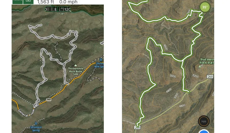
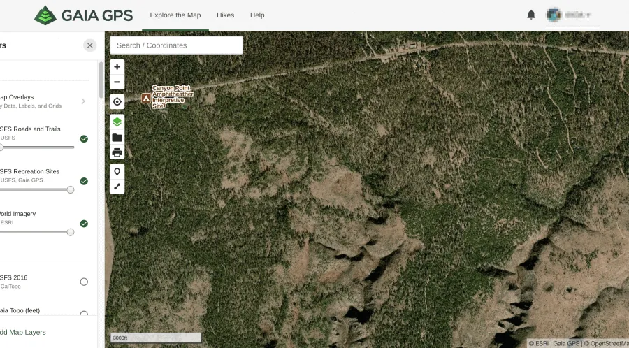
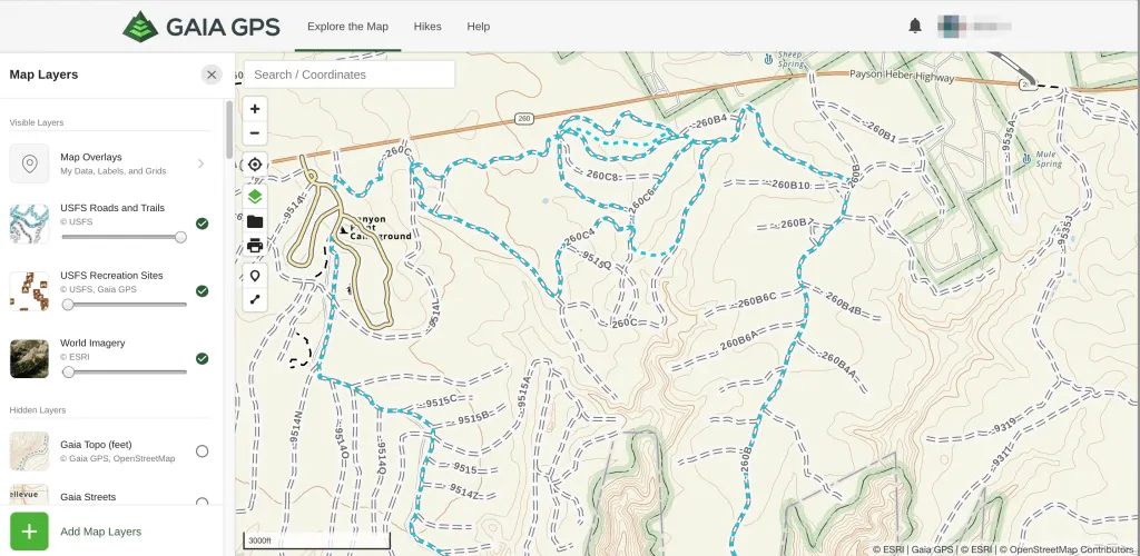
We first start with satellite imagery and then add a topo layer to see what trails may be marked. If available we prefer the USFS Roads and Trails Layer (https://blog.gaiagps.com/unlock-new-routes-with-the-usfs-roads-and-trails-overlay/) or USFS 2016. Each provides excellent detail including the names of forest roads.
 World Imagery and USFS Recreation Sites layers displayed.
 Here’s an example of layering maps to find a potential route.
Creating a Route -
Within the app or on gaiagps.com you can create a route with the route planner. The tool won’t always snap to the exact trails you want. You may need to shorten the length of the segment you are trying to draw. Worst case create extra data points and mark key turns with waypoints. If the route is fairly straightforward we only use waypoints. Then we will record an actual track on our discovery run.
 gaiagps.com route planning. The app snaps to trail the route from the starting point to the endpoint.
 gaiagps.com - Here the app is unable to create a route with only 2 points. We simply add more points along the track we want to explore to create a route.
Once you have a plan in place and have created a route or marked waypoints make sure you download your preferred map layers for offline use. The new Gaia Topo layer is a great low overhead (storage) option. We have downloaded entire states with this layer. Regardless if you have created a route on your mobile device or gaiagps.com your data will sync to all of your devices. (Official Help Files) https://help.gaiagps.com/hc/en-us/articles/115009274487-Using-Offline-Maps
An easy way to download map data in the app is to go to any saved track, tap the … icon on the top right of the screen, then choose “Download Maps for Track.” When you tap that the app will ask you what map layers you want to download and at what quality. Low, Medium, or High.
(Official Help File) https://help.gaiagps.com/hc/en-us/articles/115003524827-Download-Maps-Along-a-Track-or-Route
Importing Tracks -
There are many sources on the internet for GPX tracks. Some are free, some are one time purchases, and some are a subscription service like TrailsOffroad.com. Popular forums like Overland Bound and Expedition Portal can have tracks linked to posts and of course sites like ours share tracks. Using your favorite search engine to find tracks is a good way to go. For example, search “El Camino Del Diable GPX” and see what comes up.
(Official Help Files)
iOS - https://help.gaiagps.com/hc/en-us/articles/115003639048-Import-GPX-and-KML-files-in-Gaia-GPS-for-iOS
Gaiagps.com - https://help.gaiagps.com/hc/en-us/articles/115003525347-Import-GPX-KML-or-FIT-Files
Once a track has been imported it is time to review it. Our personal preference is using the iPad. Others may prefer gaiagps.com. During the review we take notes, may add our own waypoints, and research which map layers provide the most detail for the given track.
For a longer overlanding trip like the Utah BDR, https://ridebdr.com/utbdr/. We mapped out our own estimated daily endpoints. We also mapped out 3 different camping choices. One if we need to stop early, one for our planned camp, and one if we are ahead of schedule and wish to travel further. We also map out exit points to main roads in case we have an emergency. Of course, once we made the trip we marked additional waypoints along the way.
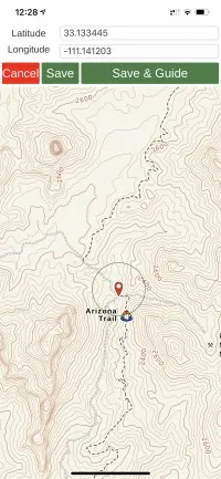
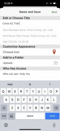
Marking/Creating New Waypoints -
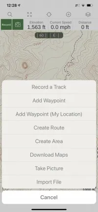
You can create a waypoint while on the trail by simply tapping the (+) symbol on the top toolbar. From there you can choose Add Waypoint, Add Waypoint (My Location), or Take Picture. If you choose Add Waypoint you can drag the waypoint to the desired location. Either way, when you hit save Gaia GPS allows you to name the waypoint, choose a folder for it, and make the waypoint public or private.
 |  |  |  |
|---|---|---|---|
 Waypoint with photo sample Waypoint with photo sample |
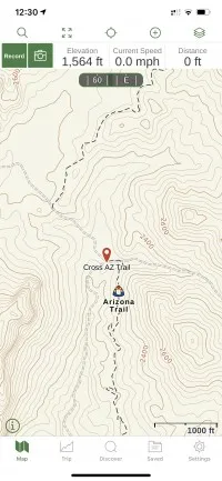
Recording Tracks -
The heart of using Gaia GPS. Record what you do. Be it off-roading, overlanding, hiking, mountain biking… ok you get the idea.
Whenever we hit a trail we record a track regardless if we have an existing track or not. Conditions can change, the trail may have changed, and so on. It is always good to have a current track.
Gaia provides a wealth of data with each recorded track.
What map layers do we prefer?
Depending on your location some of our preferred map layers may not be available. Gaia Topo will always be available though. The key is to preview different maps for the area you want to explore. For further details on our favorite map layers, we have provided links to articles from Gaia GPS.
USFS 2016 - https://blog.gaiagps.com/build-usfs-maps-gaia-gps-map-overlays/
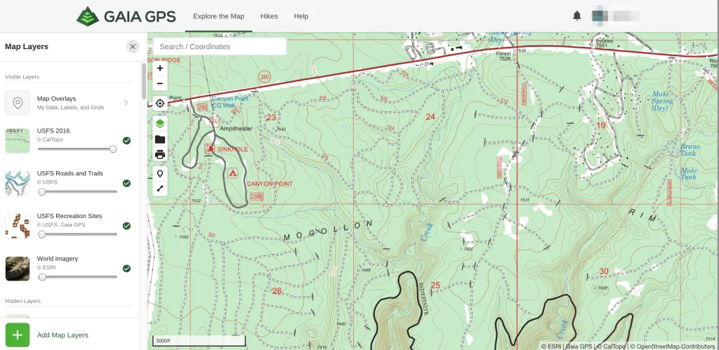
MVUM - https://blog.gaiagps.com/updated-mvum-and-usfs-roads-and-trails/
USFS Trails and Roads - https://blog.gaiagps.com/unlock-new-routes-with-the-usfs-roads-and-trails-overlay/
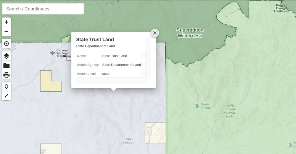
 Click on a marked forest road. Gaia will provide more details.
Gaia Topo - https://blog.gaiagps.com/easy-to-read-tiny-to-download-the-all-new-gaia-topo/
 Gaia Topo in darkmode.
NatGeo (National Geographic) - These are very detailed map layers with lots of Point of Interest data https://blog.gaiagps.com/new-oregon-pacific-crest-trail-maps-by-natgeo/
Public Lands Data - This layer can help you determine where you may be able to camp. https://blog.gaiagps.com/updated-public-lands-in-gaia-gps/
Other Map Layers We Like -
- US State and County Boundaries
- USGS Topo (CalTopo)
- USGS Topo (ESRI)
- Precip Forecasts
- Private Land
- Wilderness Areas
To view all of the map layers Gaia GPS has to offer you can preview the entire map catalog here.
How to organize all of your data -
We organize all of our data with folders. Each track or route has a dedicated folder. The folder may include multiple tracks and waypoints.
In Summary
Gaia GPS is an incredible mapping tool. We wouldn’t leave home without it. While we have paper maps we rarely use them. It does take time to learn Gaia. If you are not familiar with the app the time invested in viewing some of the official help files is well worth it. Some of the content here like plotting routes may eventually get a dedicated article with more detailed instructions. Always refer to the Gaia GPS knowledge base for up to date information. Gaia updates the app frequently.
Gaia GPS is a free app with 3 levels of membership. Free which gives you the default Gaia topo map layer for online use. Membership which expands the map collection and allows you to download maps for offline use. Premium membership. Premium unlocks all of the maps and allows you to layer maps. We use and recommend the premium membership.
Don’t forget you can save on your Gaia GPS membership subscription by visiting
(https://www.gaiagps.com/4xoa/). We receive a small commission for the referral.